Image by Sergio Cerrato – Italia from Pixabay
Snow can tell you a surprising amount about your land. From snow patterns and drainage to frost lines and slopes, learning to read the winter landscape will give you a wealth of information about the topography of your property. And by learning this secret snowy language, you’ll save time, money, and effort in future development projects. So check out LandCentral’s Reading the Winter Landscape: What Snow Can Tell You About Your Land:
1. Snow Patterns: Tracing the Contours
Snow cover often settles in ways that reflect the underlying topography. The way snow accumulates or melts can hint at slopes, depressions, and areas of exposure. These patterns are one of the easiest ways to visually assess the terrain:

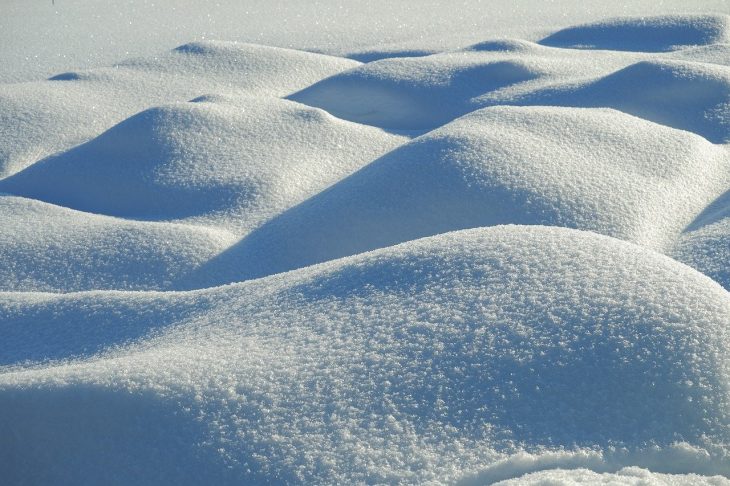
- Accumulation in Depressions: Low-lying areas or depressions tend to trap snow, causing heavier accumulations. These areas can indicate natural valleys, swales, or even old riverbeds. If you notice snow piling up in certain spots, it may mean areas that hold water or could become flood-prone during the spring thaw.
- Windblown Patterns on Slopes: On hillsides or sloped terrain, snow is often blown off of steeper surfaces while settling in more sheltered areas. This can help you identify areas where wind exposure is more intense, which could impact building design, vegetation choices, and even the orientation of structures to minimize the effects of wind erosion or snow accumulation.
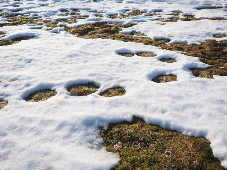
- Snow Melt Rates: Where the snow melts faster could point to areas with more direct sunlight exposure. These areas will tend to have a different microclimate compared to north-facing slopes, which remain cooler and retain snow longer. These differences could affect both agricultural potential and how feasible it is to develop on it.
2. Drainage Patterns: Understanding Water Flow
Winter snowmelt is a powerful tool for observing the natural drainage of land. How snow behaves during the spring thaw reveals key information about the flow of water on the property. Pay close attention to where the snow melts first and how it drains away.

- Meltwater Channels: In areas where snow melts rapidly and leaves behind flowing water, you may be able to see subtle water channels or pathways that indicate where drainage flows naturally. These areas may also become more pronounced in the spring, potentially leading to flooding or erosion. Understanding these drainage patterns is crucial for identifying areas that might cause issues to future construction.
- Pooling and Ice Puddles: Areas where snow remains compacted or turns to ice and water pools may indicate poor drainage or places where water collects rather than flowing off the property. This could suggest that the ground is flat, or there are underground water sources that prevent proper runoff.
- Slope and Drainage Integration: Steeper slopes generally promote quicker runoff, while flatter areas slow the water down, allowing for greater potential for erosion or water-logging. The condition of snow and how it drains in combination with slope data can help predict areas where you may need to plan for erosion control or extra measures for stormwater management.
3. Frost Lines: Revealing Soil Characteristics
Frost lines— not Jack Frost’s wrinkles, but the depth to which the ground freezes in winter—can provide a wealth of information about soil type, moisture levels, and even the potential for frost heaving. These lines often manifest as patterns in the snow, where thawed areas are visible in places that don’t freeze as deeply.

- Shallow Frost: If the frost line is relatively shallow, it may indicate that the soil is well-drained or sandy, as these soils typically freeze and thaw more quickly than heavier, clay-based soils. Shallow frost lines could be ideal for foundations, as the soil might not shift as much over the winter, reducing the risk of structural movement due to freezing and thawing cycles.
- Deep Frost: Conversely, areas with a deeper frost line typically indicate denser, wetter soils, such as clay or loamy soils. These areas might be prone to frost heaving—an issue where soil expands and contracts as it freezes and thaws, potentially damaging foundations, roads, and other infrastructure.
- Uneven Frost: Uneven frost depth can reveal more about your soil’s composition. In areas where frost penetrates deeply but not in others, you may find pockets of moisture retention or clay-rich layers. Understanding these inconsistencies can help determine where water will accumulate or where the ground will freeze and thaw differently, allowing you to anticipate areas that might need additional groundwork.
How to Identify if the Land is Right For You
Snow’s behavior across the landscape gives a preview of the potential challenges you might face when it comes to land development. Whether you’re building a house, designing roads, or planning agricultural use, snow patterns provide a snapshot of how the land behaves under both natural and artificial stress.
For Development – A well-drained, gently sloping site with no deep frost lines may offer the easiest development conditions.
For Building – Pay attention to snowmelt and drainage. Understanding these will help you avoid problems with water intrusion into foundations or soggy terrain that could lead to structural issues. Similarly, knowing the frost lines in advance will allow you to design foundations that minimize the risk of shifting or cracking in the winter months.
For Agriculture – Snow patterns will show you areas with good sunlight, moisture retention, and ideal soil conditions, while also warning you of areas that might be prone to erosion or freezing.
Botton Line – Areas that trap snow or exhibit poor drainage could require more preparation and investment. Not impossible, just know what you’re getting into before you buy.
So there you have it. By observing how snow behaves on a potential property you can stay one step ahead of your investment. So before you build, farm, or invest in land, take the time to step outside and observe the snow. The patterns left behind by winter’s chill could help you make a more informed decision and more importantly, save you time, money, and stress in the long run. It’s like having a natural map of your land’s strengths and weaknesses, written in snowflakes. And when you’re ready to buy, we’ve got you covered.